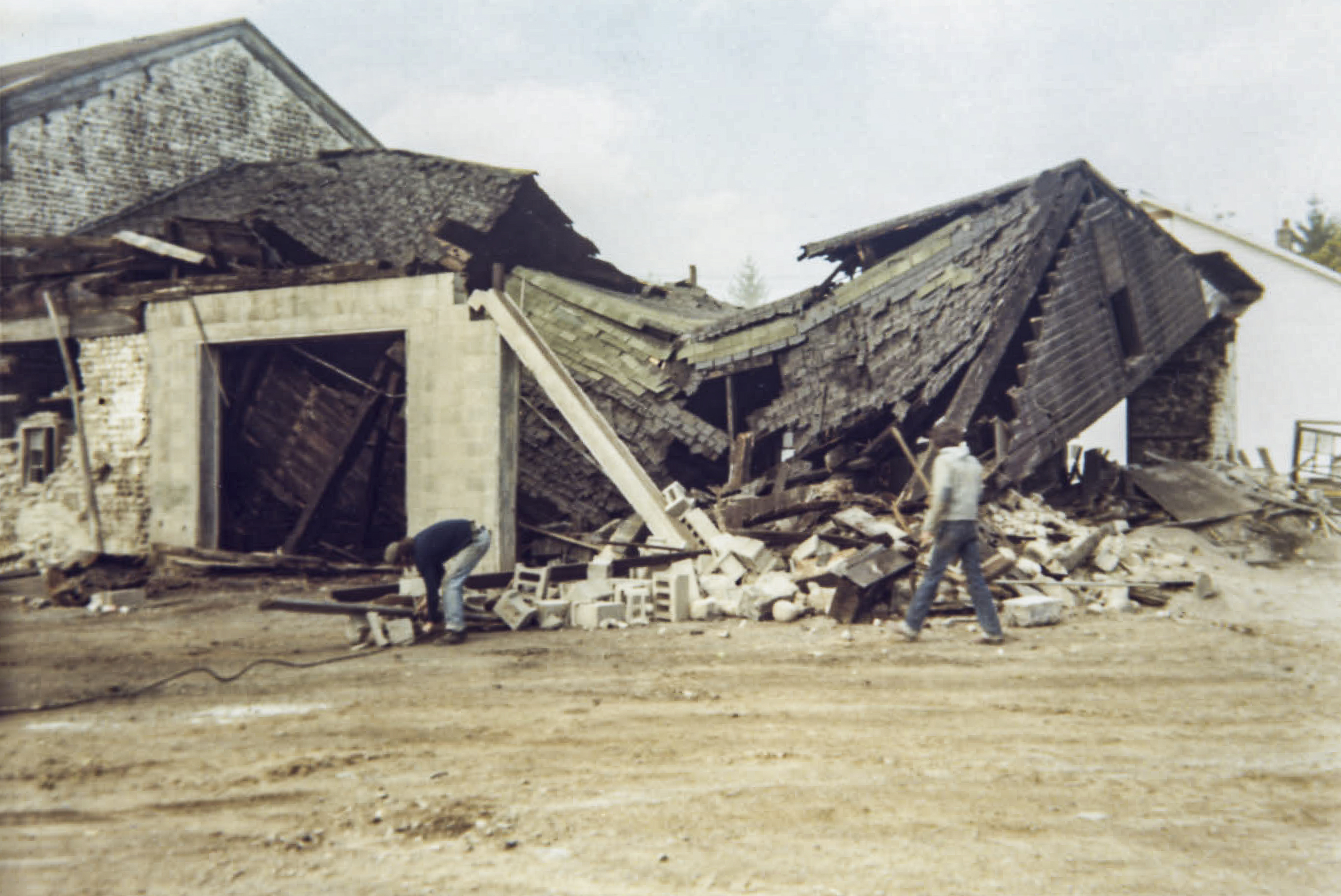
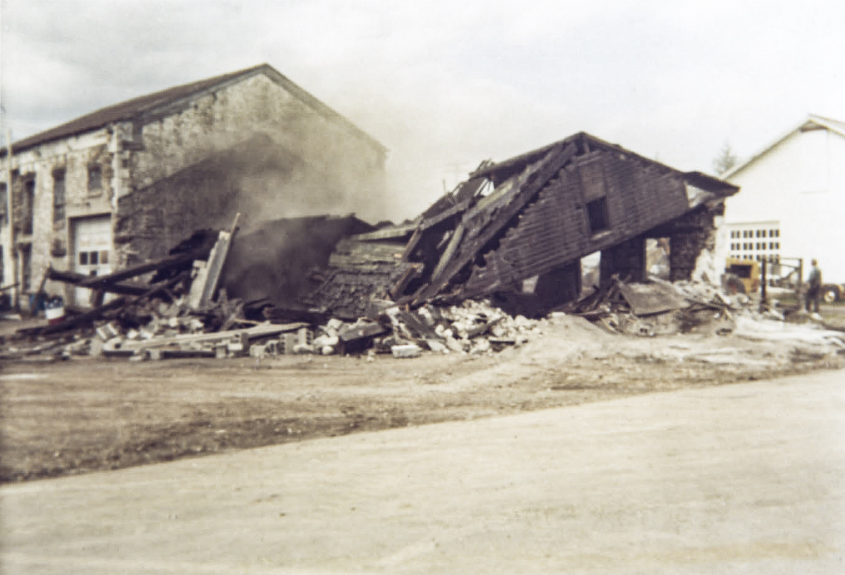
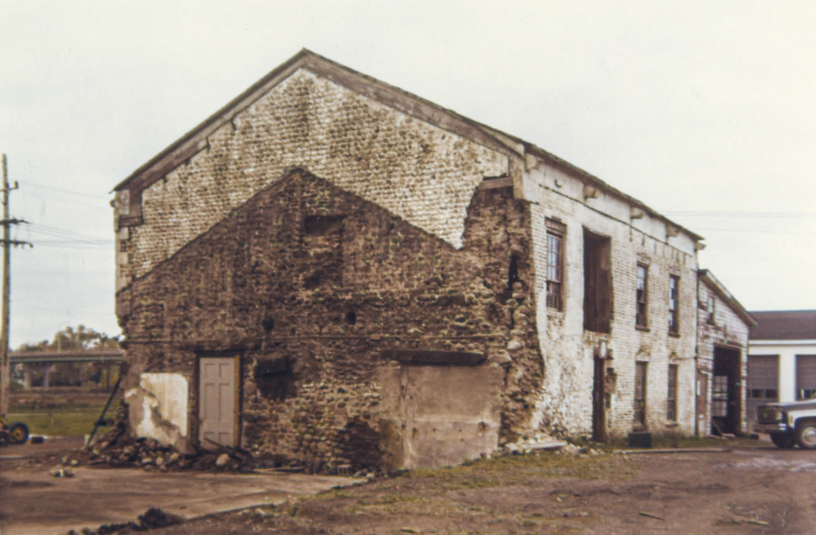
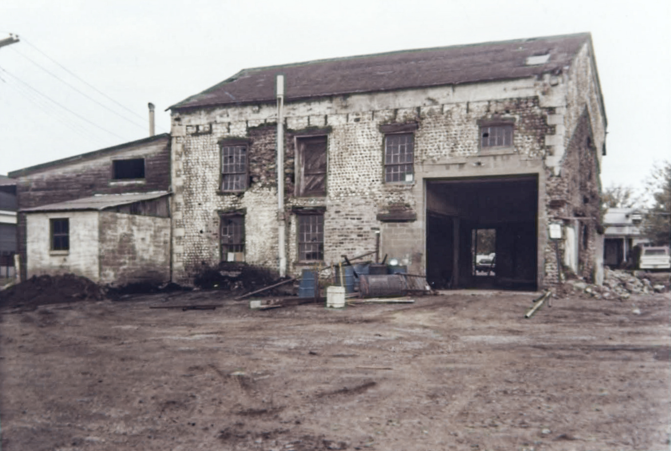
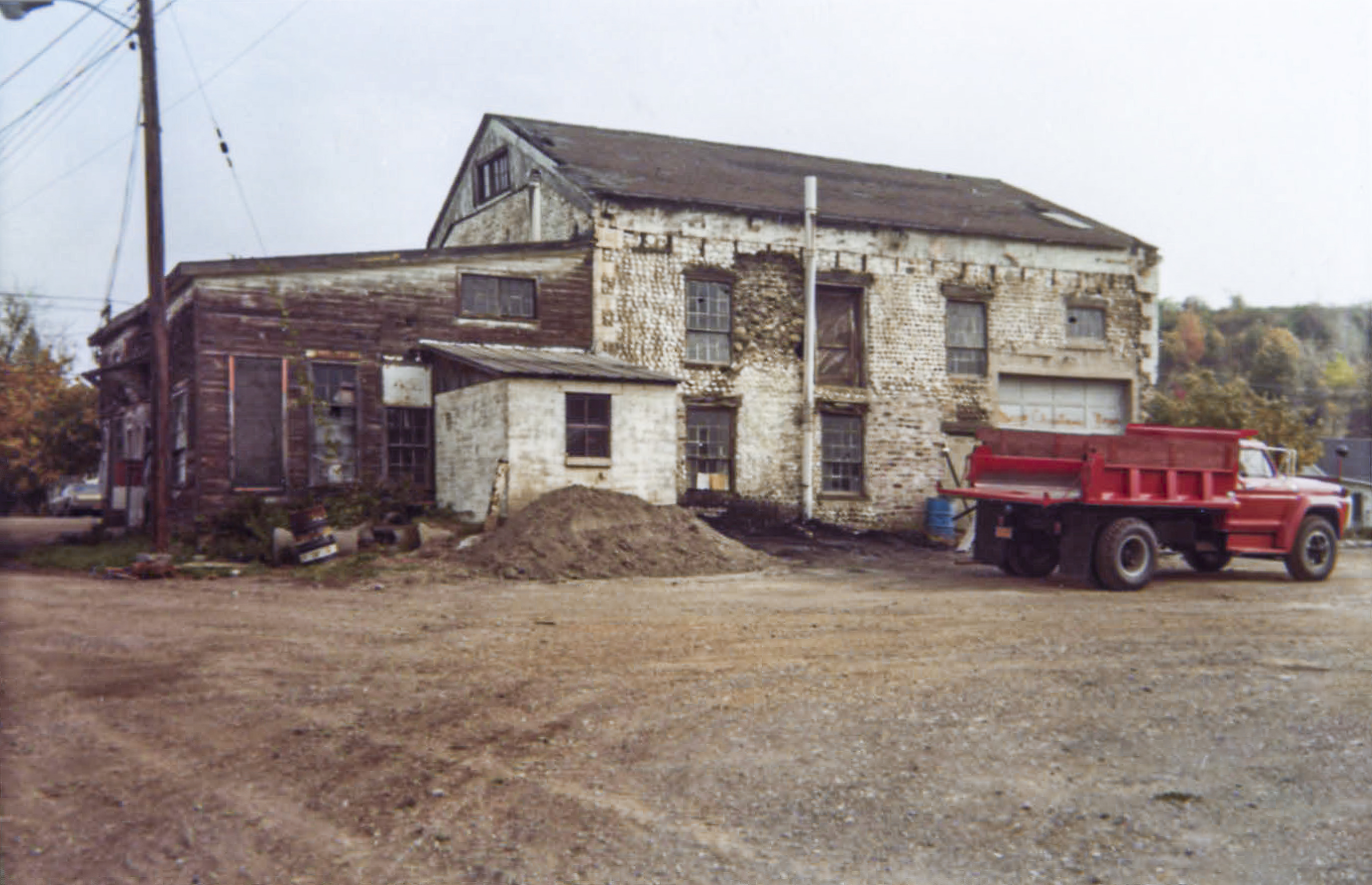
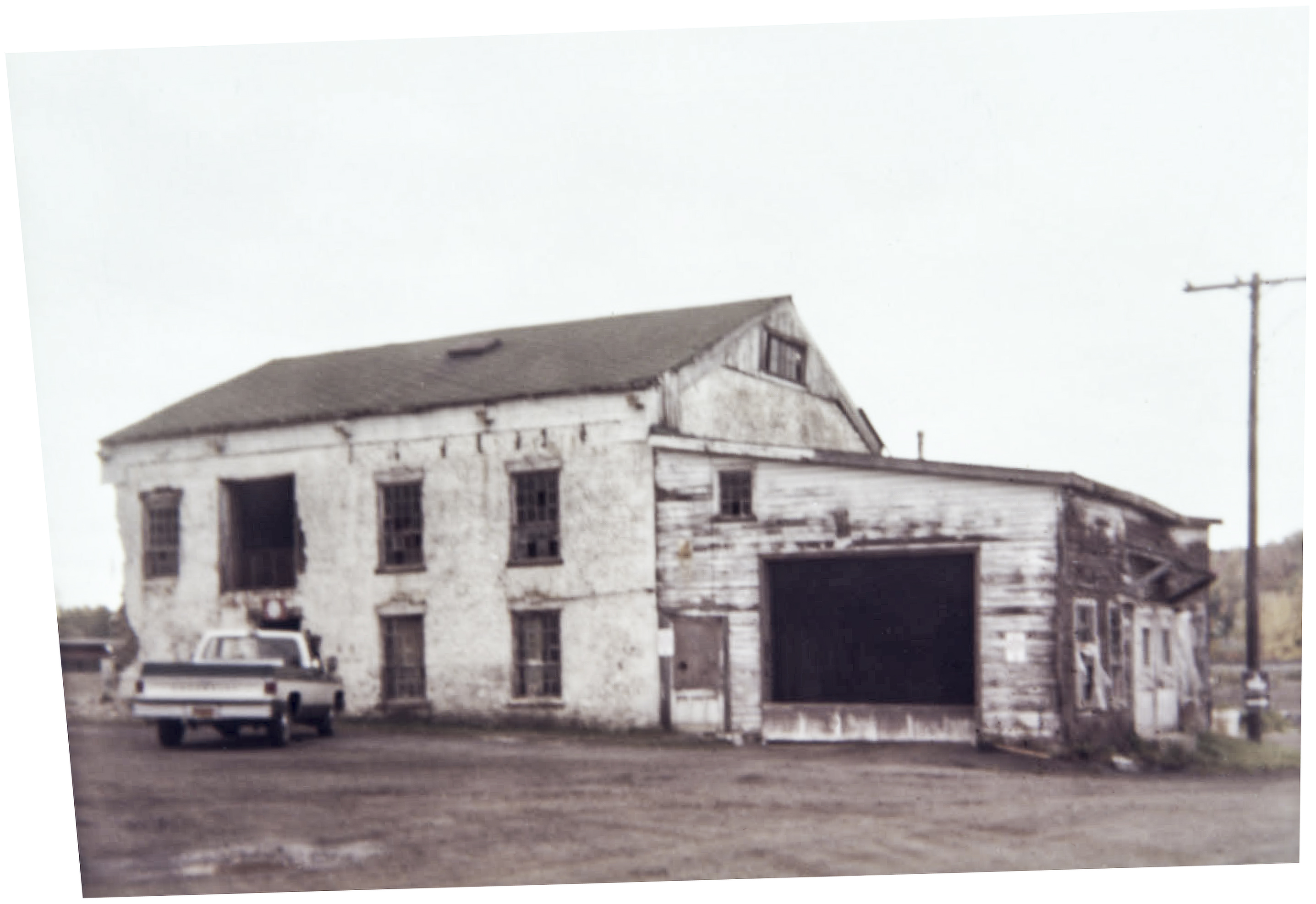
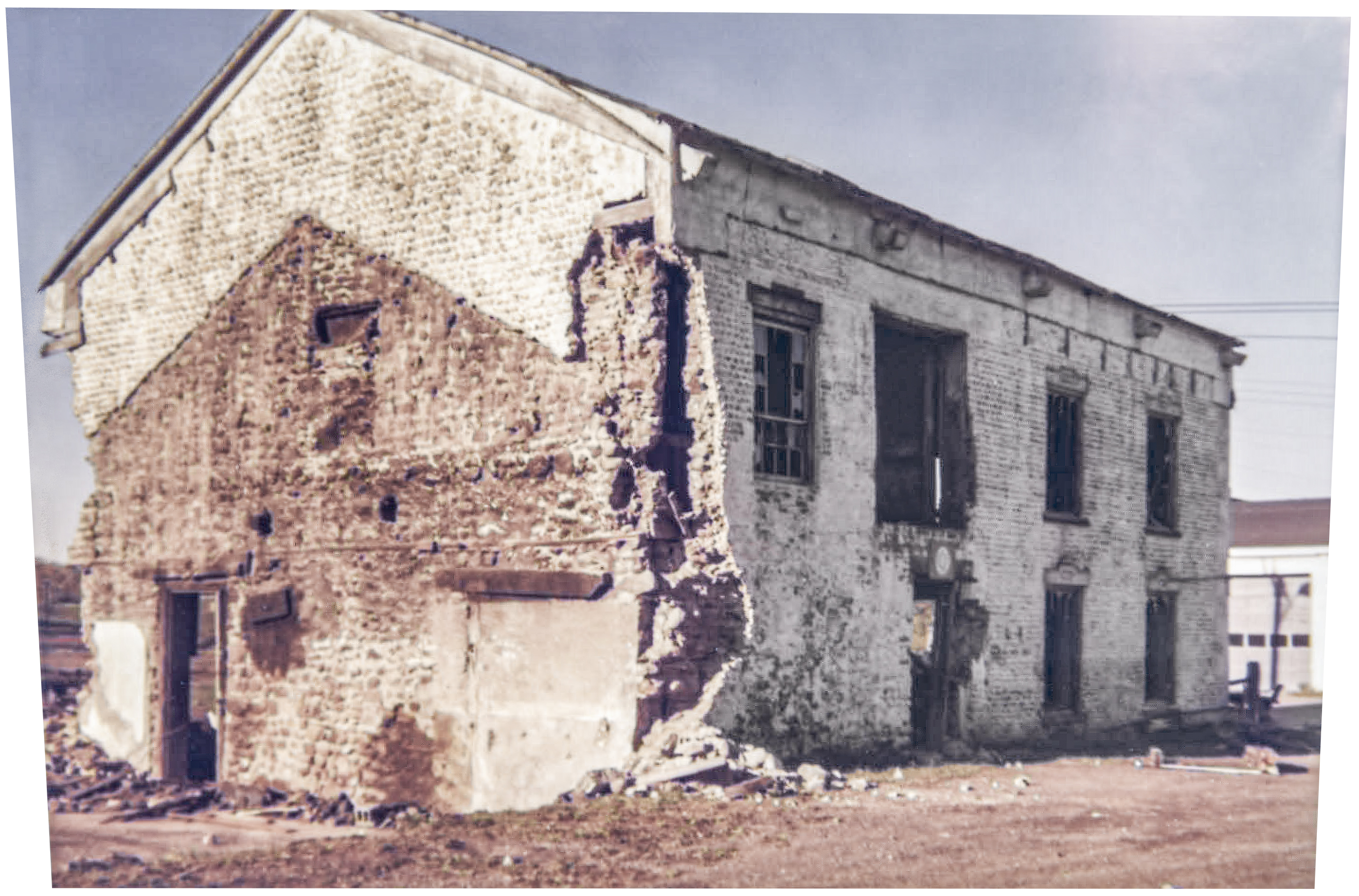
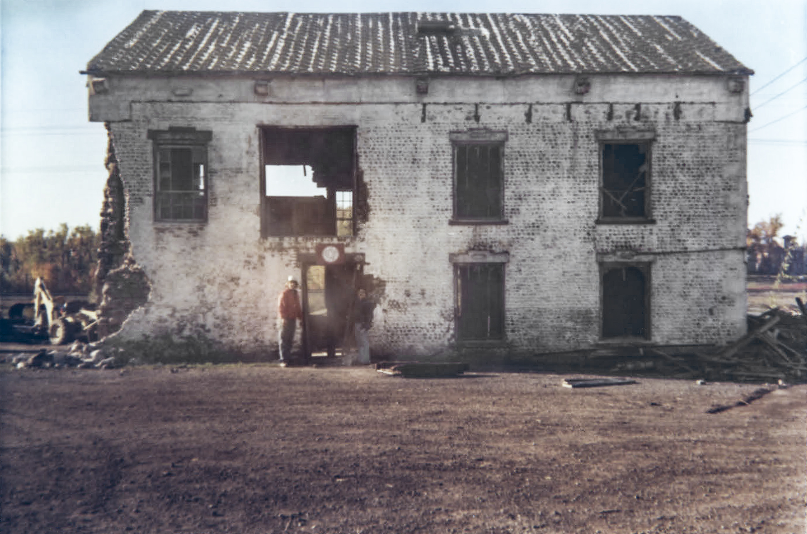
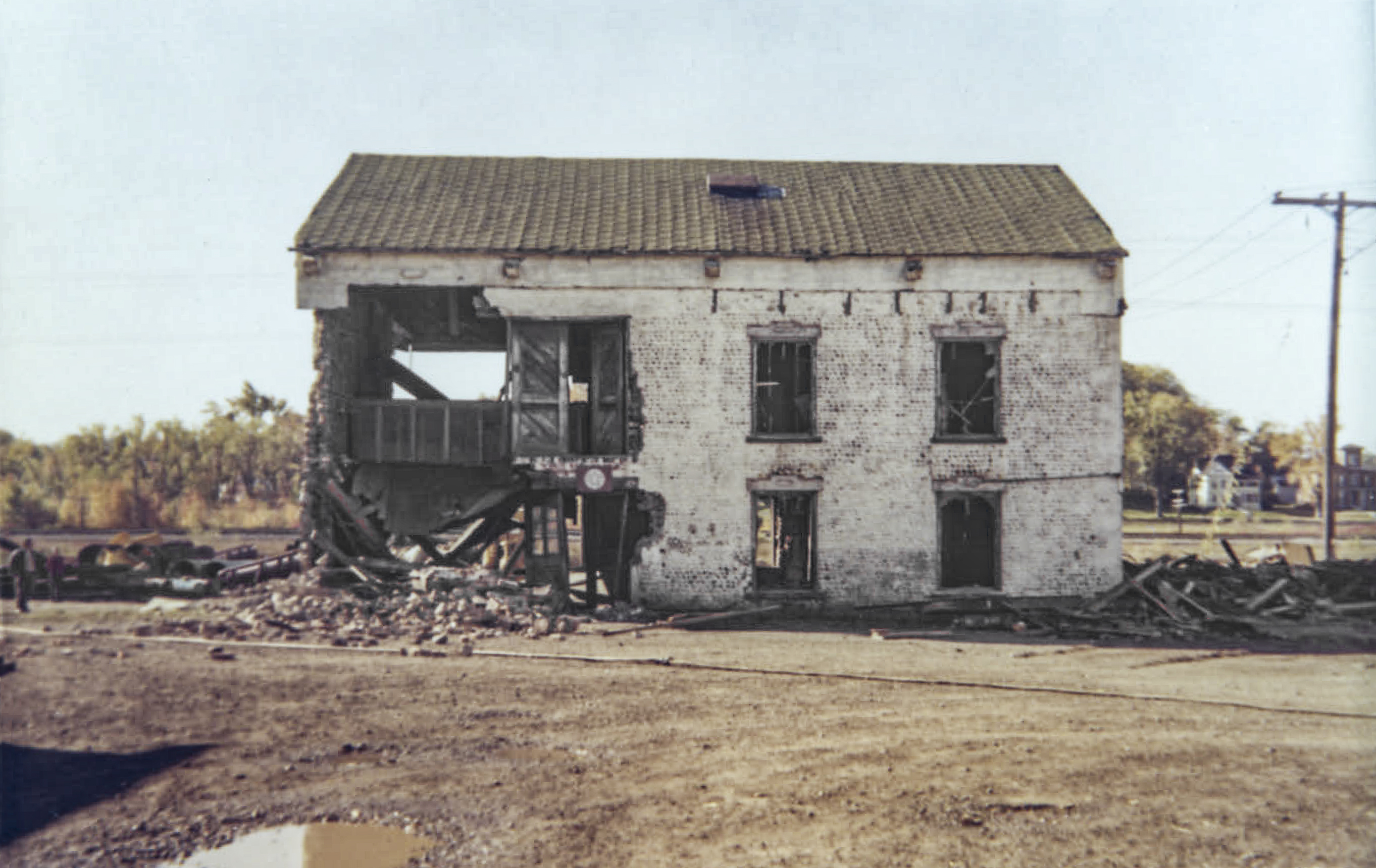
Building date: 1843, demolished 1979
Original use: Foundry
Corner structures:
Mortar application and content:
Types and uses of stones:
Types and choice of windows:
Structures with similar masonry details:
Masons who worked on building:
Unique features:
Map views courtesy Google Maps. Approximate location is Google Earth confirmed; 43°04'55.90"N 76°52'06.89"W.
Town of Galen and Wayne County Maps
Dolph, Humphrey & Co. Foundry history sheet. From the personal research of cobblestone historian Karen Crandall.
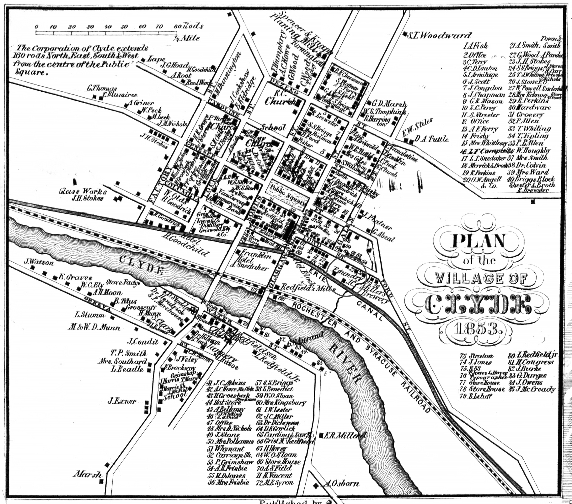
¹ 1853 Wayne County Gal-9 Excerpt Map courtesy Library of Congress.
² Image courtesy Clyde-Savannah Public Library.
